Anthropogenic Heat
GIS-Based Analytical Model (Urban Scale)

Impact of Urban Morphology and Anthropogenic Heat Dispersion on UHI
Anthropogenic heat is one of the key factors that causes intensive Urban Heat Island (UHI) due to its direct impact on ambient temperature in urban areas. Stagnated airflow due to closely packed tall buildings causes weak dilution and removal of anthropogenic heat. Consequently, research is critically needed to investigate the effect of urban morphology on anthropogenic heat dispersion and provide effective planning strategies to reduce UHI intensity, especially at the extreme scenarios, such as with very low wind speed and high heat emission.
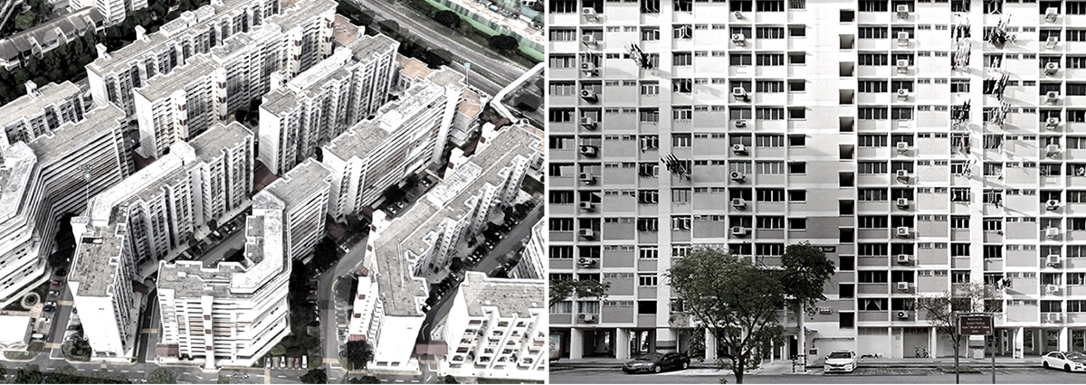
Figure. Air conditioning emission from residential buildings.
This study provides scientific understanding and develops a Geographic Information System (GIS)-based modelling tool to support decision-making in urban planning practice. We start from a computational parametric study at the neighbourhood scale to investigate the impact of urban morphology on heat dispersion. Site coverage ratio and frontal area density are two urban morphological parameters. Ten parametric cases with two heat emission scenarios are designed to study representative urban areas.
Furthermore, based on the energy conservation within urban canopy layers, we develop a Geographic Information System (GIS)-based model to estimate dynamic in-canopy air temperature increment, in which the exchange velocity between street canyons and overlying atmosphere is estimated by the Bentham and Britter model. The performance of new model is validated by cross-comparing with Computational Fluid Dynamics (CFD) results from the parametric study. By applying this new model, the impact of anthropogenic heat on air temperature is mapped in residential areas of Singapore for both long-term annually averaged and short-term extreme low wind speed to improve urban climate sustainability and resilience.
Outputs:
- A new GIS-based analytical model is developed to model and visualise the transient street air warming process due to anthropogenic heat emission;
- Model performance is calibrated and validated by cross-comparing with LES results. A position-dependent buoyancy coefficient is proposed based on LES;
- A transformation of the in-canopy flow structure is found in the transient period due to large-scale turbulence structure;
Publications:
- SJ Mei, Yuan C, 2021, Analytical and numerical study on transient urban street air warming induced by anthropogenic heat emission, Energy and Buildings, 231, pp 110613.
- Yuan C, Adelia AS, Mei SJ, He WH, Li XX, Norford L, 2020, Mitigating intensity of urban heat island by better understanding on urban morphology and anthropogenic heat dispersion, Building and Environment, 176, pp 106876.
Conference Presentations:
- Yuan C, Mei SJ, Adelia AS, Zhu RX, He WH, Li XX, 2020, Anthropogenic Heat Dispersion Modelling for Better Urban Planning at High Density Cities, Proceeding in Passive Low Energy Architecture Design to Thrive (PLEA). A Coruña, Spain.
Press releases:
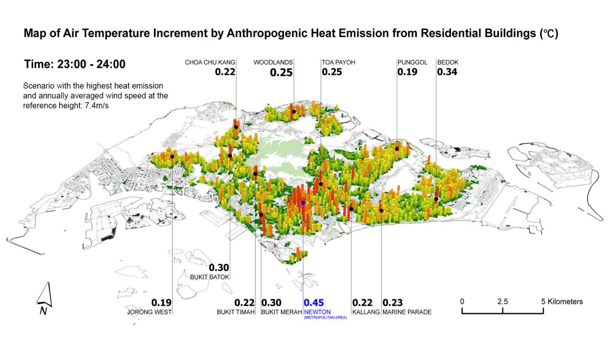
Figure. Impact of anthropogenic heat on air temperature.