Resources

[ CLOSE ] SECTION MENU
  • 1
Data

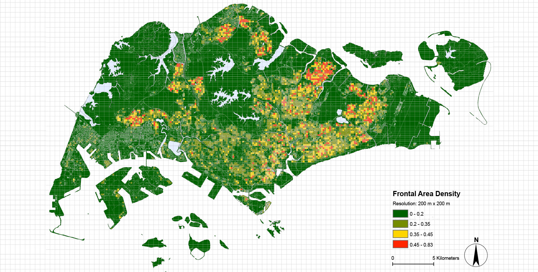
FAD was calculated at each cell (200 m x 200 m), based on the 3D building geometry data purchased from AW3D company in Japan and the prevailing wind directions in 2015.

Data

SVF was calculated at each cell (200 m x 200 m) based on raster algorithm, using the 3D building geometry data purchased from AW3D company in Japan.

Data

Temperature increment caused by anthropogenic heat dispersion was estimated at each cell (200 m x 200 m) at residential areas in Nov 2015.

Data

Site Cover Ratio was calculated at each cell (200 m x 200 m), using the 3D building geometry data purchased from AW3D company in Japan.

Toolkit

Frontal Area Density Tools includes 2 tool: frontal area density from single direction; frontal area density from prevailing wind directions.

Toolkit

Sky View Factor Tool is based raster algorithm to calculate the sky view factor, requiring a raster data representing urban morphology.

Toolkit

Temperature Increment tool is to calculate temperature increment caused by anthropogenic heat dispersion.

Toolkit

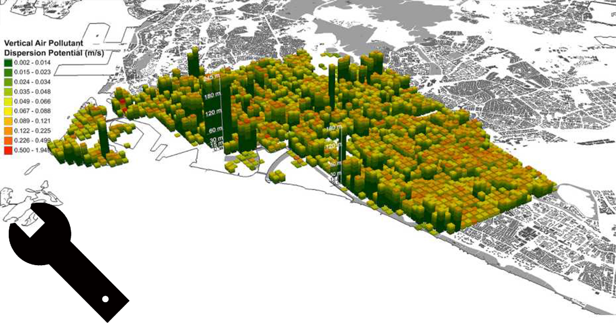
Multiple Air Pollutant Dispersion Tool is based on a semi-empirical multilayer urban canopy model to estimate the vertical dispersion of traffic emissions in high density urban areas.