Data
Frontal Area Density (FAD), 2015
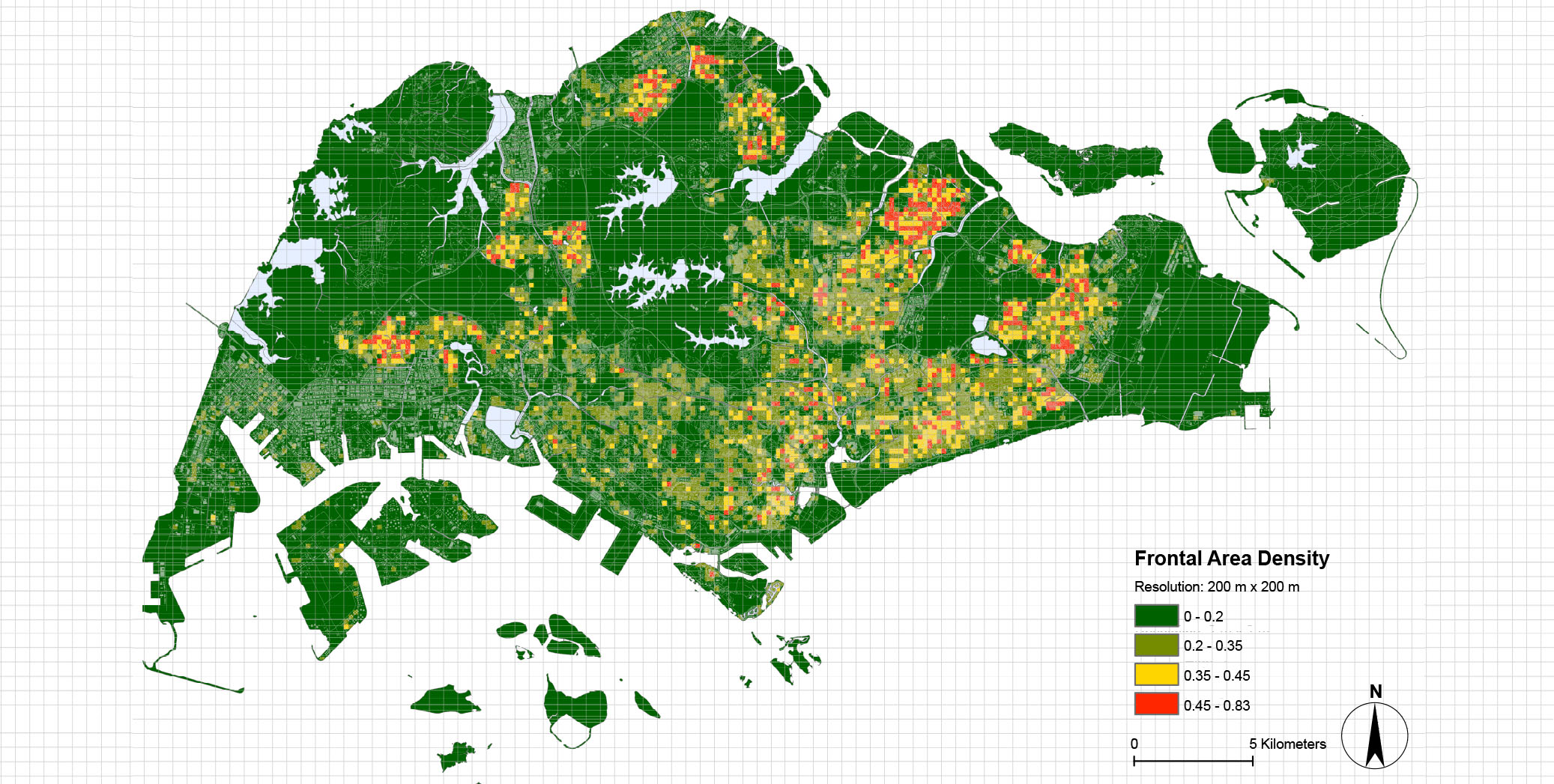
Year: 2015
Format: TIF/TXT
Coverage: Singapore
Source: Calculation result based on urban morphology data (3D building geometry data Buildings in 2016)
Resolution: 200m
Description: FAD was calculated at each cell (200 m x 200 m), based on the 3D building geometry data purchased from AW3D company in Japan and the prevailing wind directions in 2015. The height of canopy layer is assumed as 28m.
Data availability : Derived data supporting this map are available from Zhang Liqing (akiliqi@nus.edu.sg) on request.