Toolkit
Temperature Increment Tool
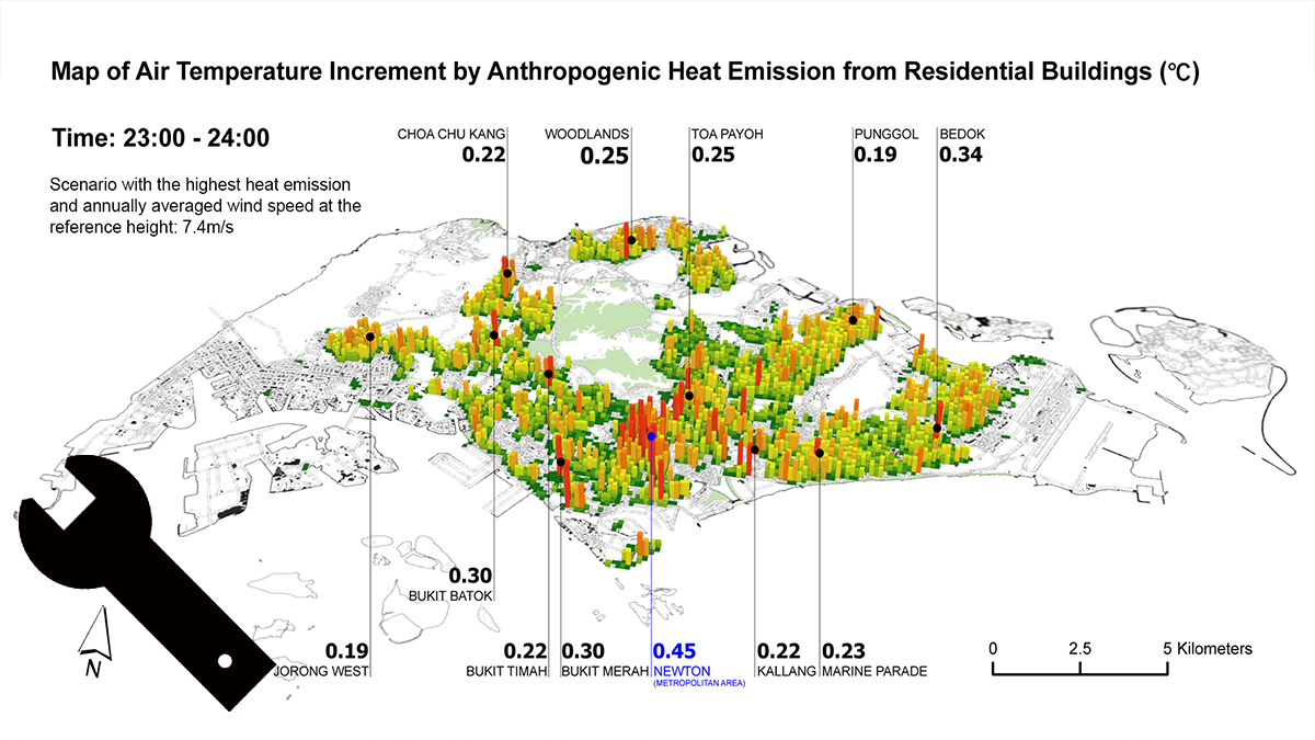
Description: Temperature Increment tool is to calculate temperature increment caused by anthropogenic heat dispersion. It works at high-density residential area based on semi-empirical model. It requires raster data representing anthropogenic heat, frontal area density and site cover ratio, respectively.
Install Requirement: ARCGIS Desktop 10.7 and above version, Spatial Analyst License
Availability : This GIS tool and its instruction are available here.