

Introduction
The Centre for Sustainable Asian Cities (CSAC) serves as a dynamic hub for developing innovative urban planning, design solutions, and advanced building technologies tailored for high-density environments. These solutions are designed to be applicable not only to cities across Asia but also to other developing regions facing similar challenges.
CSAC complements national efforts, particularly those led by Singapore’s Ministry of National Development, by contributing research and expertise to create practical solutions and establish best practices for more sustainable and liveable cities.
The Centre actively collaborates with international universities and organises research workshops and seminars. Through these events, CSAC brings together experts to discuss pressing issues, co-develop solutions, and share research findings and ideas.
With a strong focus on Asian urban contexts, CSAC aims to advance knowledge in sustainable city development, shape professional practices, and influence thinking within the field of urban sustainability.
(Image sources: https://designsingapore.org/initiatives/loveable-singapore-project/; PLAB: A Research and Design Investigation of the Redevelopment of the Paya Lebar Airbase; Typology Study for Public Housing in Dover)
Research Projects

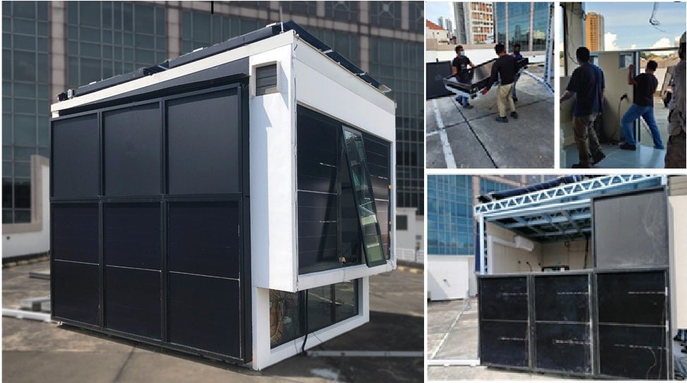
This multidisciplinary research project tackles critical challenges in decarbonising the construction sector, enhancing building energy sufficiency, strengthening food security, and bolstering urban resilience. The project focuses on developing innovative, high-performance façade systems for multi-storey buildings using low-carbon materials, such as mass timber, which are integrated with active technologies for renewable energy production, including Building-Integrated Photovoltaics – BIPVs, and vertical farming (Building-Integrated Agriculture - BIA).

This study proposes a systematic research framework that leverages intelligent technologies to augment researchers’ intuition in mapping or uncovering the genealogy of vernacular architecture and its connotative socio-cultural systems. The proposed vision-intelligent framework is predicated on the premise that the interpretation of historical artefacts is a process of identifying a function f from a discrete data set. This process begins with the formulation of a hypothesis, followed by three phases - collection, categorisation, and interpretation - and culminates in the verification of the hypothesis and the articulation of final explanations.

This study seeks to develop a health district framework to help planners and policymakers assess planning scenarios at the town level in Singapore, reviewing relevant literature, identifying key components and quantifiable indicators, and creating planning principles for evaluation. The framework aims to guide planning practices and policy formulation, and future work will focus on measuring the importance of each component to support comprehensive multi-criteria decision-making.
")
NUS, in partnership with the National University Health System (NUHS), Housing & Development Board (HDB), and other stakeholders from the public, private, and people sectors, has embarked on a pioneering collaboration to develop the Health District @ Queenstown pilot project. As part of this initiative, the Centre for Sustainable Asian Cities at NUS conducted the ‘Healthy District Baseline Study of Dawson’. This study aimed to identify the health priorities and environmental needs of Dawson residents, pinpoint existing gaps, and guide the development of healthy districts across Singapore.

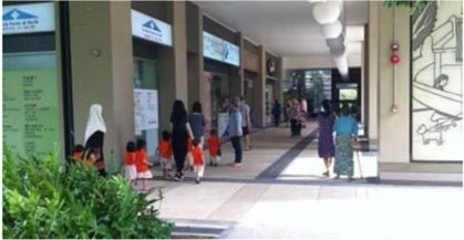
NUS conducted two studies: one developed a knowledge framework on what makes places “loveable,” while the other used design ethnography to explore how Singaporeans form attachments to eating spaces and public areas in HDB neighbourhoods. Guided by research questions on tangible and intangible aspects of place attachment, the studies combined literature review, field observations, and other engagement methods to better understand different perceptions of loveability in urban spaces.

The NUS Centre for Sustainable Asian Cities (CSAC), in collaboration with the Urban Redevelopment Authority (URA), brought together a multidisciplinary team to redesign the 1,870-hectare site comprising PLAB and its surroundings. Building upon CSAC’s work on the “1-minute neighbourhood” at Dover Road, this study refines the land use concept of "bands" applied at various scales to boost accessibility, connectivity, and urban convenience.
Our Publications