Urban Climatic Mapping Studies for Singapore
Principal Investigator: Prof Wong Nyuk Hien
Introduction and Background
The urban environmental quality has worsened every year. It is a fact that the urban air temperature is gradually rising in all cities and some effective measures are needed to mitigate it. The major causes include diminishing of green areas, low wind velocity due to high building density and change of street surface coating materials (Takahashi, 2004). This may lead to overheating by human energy release and absorption of solar radiation on dark surfaces and buildings. This problem will be further aggravated by increasing demand on air conditioning, which will again lead to further heating and CO2 release (Crutzen, 2004).
Urban Heat island (UHI) can be observed in every town and city. In Washington and Tokyo, a rate of one-half to one degree Fahrenheit every ten years was observed in the context of the summer’s maximum temperatures during the last 30-80 years (Landsberg, 1981). In Singapore, the satellite image shows UHI effect during daytime. The ‘hot’ spots are normally observed on exposed hard surfaces in urban context, such as industrial area, airport and Central Business District (CBD). The satellite image also shows some ‘cool’ spots, which are mostly observed on the large parks, the landscape in-between the housing estates and the catchment area (Wong, 2002).
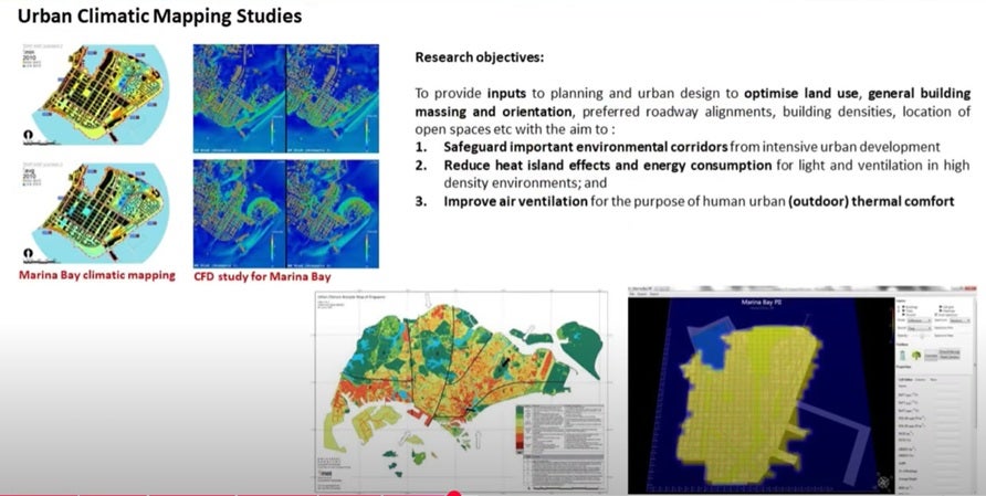
Singapore is an island state measuring 43 km across from West to East and 23 km from North to South. Singapore's land area has increased by 20% through land reclamation since year 1960 (URA, 2008). Currently Singapore is in the process of developing the Marina Bay area as an extension of the Central Business District (CBD). By replacing the dense greenery in Marina Bay area with high-rise buildings, without careful urban planning, the rising of urban air temperatures can be expected to add to human thermal stress. The outdoor condition will not be comfortable for the inhabitants. The major development of this site may also have major impact on the wind profile at the current CBD area.
Urban climatic mapping methods have become widely used for urban planning as it can provide a clear picture of the microclimatic conditions from the regional scale of 1:100,000 to the urban scale of 1:5000. By using Geographical Information System (GIS), climatic map can be developed together with analysis on different information layer.
Katzschner (2004) carried out a study on microclimate thermal comfort, developing a mapping methodology which focuses on spatial analysis of thermal comfort zones. It tried to identify the open urban spaces quality contributes to quality of life within cities. Some methodologies were employed to produce comfort zone maps, such as meteorological field survey, interview and urban morphology identification.
Katzschner and Mülder (2006) developed a regional climatic mapping method for a sustainable village development in China. Thermal comfort conditions, microclimates and ventilation patterns were studied in seven Chinese villages and climate maps drawn. The methods for the mapping are, firstly, gathering weather data from the nearby weather stations. The average values of solar radiation and temperatures were calculated by using METEONORM software. The next step was the combination of land use data, topographical information and the climatic data. Through the Geographical Information System (GIS Arc.Info), geographical and land use data were classified and transformed to urban climate functions, such as thermal aspects (i.e. heat and cooling rates), with a wind classification with air paths and topographically influenced downhill movements of air masses. The building fabric was classified according to roughness length and thermal radiation processes.

Objectives
The main objectives of the study are to provide inputs to planning and urban design to optimise land use, general building massing and orientation, preferred roadway alignments, building densities, location of open spaces etc with the aim to :
1. Safeguard important environmental corridors from intensive urban development;
2. Reduce heat island effects and energy consumption for light and ventilation in high density environments; and
3. Improve air ventilation for the purpose of human urban (outdoor) thermal comfort.


