

Enhancements in the Predictions of Sediment Transport around Singapore Coastal Waters
As part of CFI Singapore’s efforts to strengthen coastal resilience, this project aims to enhance the understanding of sediment transport by developing cost-effective, smart, data-driven remote sensing techniques for long-term monitoring of suspended sediment distributions in Singapore’s coastal waters.
Research Goals
-
Develop a coupled satellite-UAV remote sensing approach to monitor suspended sediment in Singapore’s coastal waters.
-
Investigate the sediment characteristics and determine the incipient shear stress of bed sediments in the region.
-
Enhance the assessment of sediment transport around Singapore’s coastal waters under various climate change scenarios.
Why This Matters
-
This project will attain long-term monitoring of suspended sediment by combining advanced satellite and UAV remote sensing.
-
Research outcomes will contribute to a deeper understanding of Singapore’s coastal dynamics and improve the ability to assess the performance of shore protection schemes with greater confidence.
-
A better understanding of mixed sediment transport behaviour will provide a strong foundation for testing and verifying numerical models, thereby enhancing the assessment of sediment transport influence zones and local coastal erosion.
Latest Research Highlights
-
Conducted field campaigns across multiple coastal sites to collect synchronized optical satellite and UAV-multispectral imageries.
- Developed GPS-based mosaicking and cloud-removal algorithms (using SAR satellite imagery) to improve coastal monitoring under challenging conditions.
-
Established physics-informed machine learning frameworks to enhance long-term shoreline detection using satellite imagery, to achieve higher accuracy for shoreline detection in Singapore’s urbanized environment.
- Developed an automated algorithm to extract waterlines from airborne LiDAR data under complex coastal conditions.
-
Both these processes provide long-term erosion and accretion assessments along Singapore’s coastlines.
-
Carried out extensive field sampling and analyses to characterise suspended and bed sediments along Singapore’s coast.
- Laboratory experiments are also ongoing to better quantify critical shear stress of mixed bed sediments with cross-validation using both visual judgment and extrapolation methods.
- Findings will inform numerical models that simulate sediment transport around Singapore's coastal waters and consequently contribute to coastal protection and management efforts.
Meet the Team
Meet the researchers driving the Enhancements in the Predictions of Sediment Transport around Singapore Coastal Waters project — applying advanced modeling and data-driven approaches to better understand sediment dynamics and support sustainable coastal management in Singapore.
Principal Investigator (PI):
Professor Adrian Law
National University of Singapore

Research Fellow:
Dr Zheng Fanxu
Nanyang Technological University
Co-Principal Investigator (Co-PI):
Associate Professor Chong Tzyy Haur
Nanyang Technological University
Senior Scientist III:
Dr Cheng Jun
Agency for Science, Technology and Research (A*STAR)

Co-Principal Investigator (Co-PI):
Dr Ng Wee Siong
Agency for Science, Technology and Research (A*STAR)

Senior Scientist II:
Dr Wang Yu
Agency for Science, Technology and Research (A*STAR)
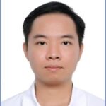
Senior Research Fellow (Senior RF):
Dr Kieu Trung Hieu
National University of Singapore

PhD Student:
Ms Lim Jing Xian
National University of Singapore
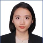
Research Associate
(RA):
Ms Trinh Ha Linh
National University of Singapore
More Projects from the H1 Domain
Explore other ongoing research initiatives under the Coastal Protection and Flood Resilience Institute (CFI) that advance Singapore’s resilience to sea-level rise, extreme weather, and coastal flooding.



Download CFI's project booklet for more information on each project
CFI Singapore Tranche 1 and 2
If you wish to reach out regarding a specific project, please email CFI Singapore at cfisg@nus.edu.sg